


 Ruined Castle Bushfire - December 2019 (Madi Maclean)
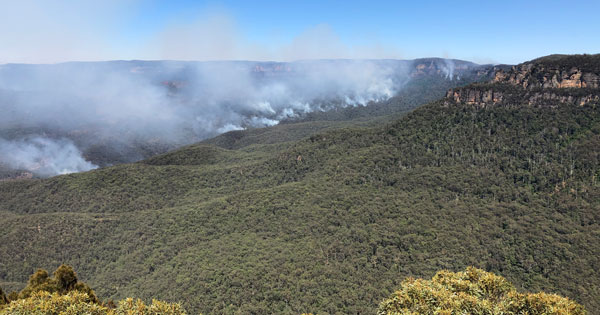
Ruined Castle Bushfire - December 2019 (Madi Maclean)
Blue Mountains Bushfire Watch
Detailed information about the 2019-20 bushfires and the effect of bushfires
on the natural environment can be found on our Bushfires webpage.
Useful resources for protecting yourself and wildlife
- Your first priority should be to make a bushfire survival plan.
- Download the Hazards Near Me app for your mobile device and set watch zones.
- NSW bushfires can be tracked at Fires Near Me. This is the information to monitor and act on.
- For a more detailed map that shows the hot spots and combines it with the Fires Near Me information see this ArcGIS webpage. Zooming in shows the detail. Magic!
- Current and upcoming hazard reduction burns are mapped and listed at https://www.rfs.nsw.gov.au/fire-information/hazard-reductions.
- Here's a list of Neighbourhood Safer Places provided by the Rural Fire Service.Remember that neighbourhood safer places are just places of last resort when all else fails. They are not a first option for leaving early.
- Information about road closures is available on the NSW Livetraffic website.
- Use Flight Radar 24 to find aerial fire fighting activity.
- Useful information about wildlife protection in relation to bushfires is available on the BMCC website.
- More information on wildlife protection is available on an app called; Help Wildlife Near Me, developed by Science for Wildlife.
© 2026 Blue Mountains Conservation Society Inc.
If you'd like to give feedback about this page please contact: webmaster@bluemountains.org.au
We acknowledge the traditional custodians of this land
the Darug and Gundungurra people
and pay respect to their Elders past and present.